|
A MAP OF IRELAND
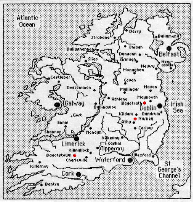
We are presenting here a map
of Ireland, consisting of both the Republic of Ireland and Northern Ireland,
now controlled by the British. The map was created by tracing a regular
map of Ireland from a computer screen and adding the cities and towns on
the map with dots, with each representing a city or town in the country.
We have put red dots on three locations of the map, representing the places
in which we find the Bagot family living according to the old records collected
from Ireland.
The Bagot families settled in
Dublin, Nurney, and County Limerick (where Bagotstown is located). The
family first settled at Wexford and branches of the family acquired land
near Dublin, where a castle was constructed and ever since called Bagotrath
Castle. They then acquired lands in County Limerick and built Bagotstown
Castle there. Christopher Bagot, father of Charles Hervey, was of Nurney
in the County of Kildare, lineal ancestor of the Australian Bagots.

|